Item
Identifier:
2021_05_012
Date
before 1932;Estimated dates
Extent
1 map
Format
map
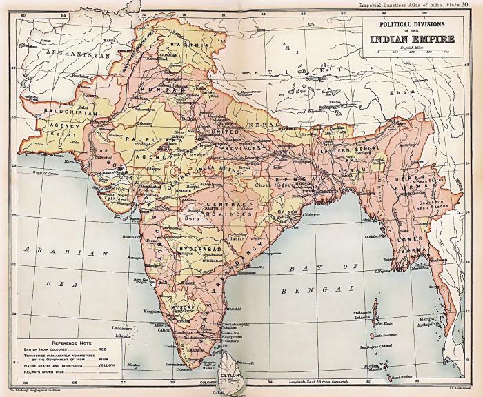
Description
A map of the Indian subcontintent denoting political divisions while under British occupation. This map was produced for inclusion in the Imperial Gazetteer Atlas of India.
Location
India
Subject Headings - Library of Congress
India--History--British occupation, 1765-1947 [http://id.loc.gov/authorities/subjects/sh85064915];India--Administrative and political divisions--Maps [http://id.loc.gov/authorities/subjects/sh2008115402];Imperialism [http://id.loc.gov/authorities/subjects/sh85064628]